
Washington Township ZIP Code Coverage
Only two narrow, official postal examples were verified in the research. The Township’s Development Services address uses a Dayton mailing label, while the Centerville-Washington Township Cemetery uses a Centerville mailing label. Those addresses demonstrate postal ambiguity. They do not document a complete Washington Township ZIP map, a complete list of ZIPs touching the Township, or the jurisdiction of every address carrying either label.
| ZIP | Areas Covered | Post Office | Notes |
|---|---|---|---|
| 45458 | Washington Township Development Services address at 8200 McEwen Road | Not identified in reviewed source; Dayton postal label | Shows one Township government mailing address, not all addresses in the ZIP. |
| 45459 | Centerville-Washington Township Cemetery address at 68 Maple Avenue | Not identified in reviewed source; Centerville postal label | Shows one Township cemetery mailing address, not a complete coverage boundary. |
A full coverage roster was not supplied by the reviewed Township, county, or USPS sources. Before treating any additional ZIP as a Washington Township ZIP code, validate representative full addresses with USPS and then verify the parcel’s location in the county systems. Postal delivery, municipal boundaries, Township service territory, and tax parcels are separate geographies.
Washington Township ZIP Code Workflow
A ZIP can start an address check, but it cannot provide a township-wide resident list. Use a single complete address to move through the postal and parcel systems in order. The two checks answer separate questions: USPS standardizes mail delivery, while the Auditor, GIS, and local jurisdiction sources identify the parcel and the custodian for property or Township records. This sequence also avoids treating a Dayton or Centerville postal label as proof of municipal jurisdiction.
- Enter the complete address in the USPS address lookup and retain the returned standardized address, ZIP, postal city, and access date.
- Use the house number and base street name in the Montgomery County Auditor Address Search. Its instructions say not to add a direction or suffix.
- Save the parcel ID, situs label, legal description, and tax year from the candidate parcel rather than relying on the postal result alone.
- Check the Auditor GIS or Township map to determine whether the point and parcel fall in the relevant Washington Township or municipal record area.
- Use the parcel ID and legal description for Recorder, Treasurer, map, and historical work. For a street-level property trail, continue with the Washington Township street directory.
The official USPS address lookup is the first address-validation step, not an owner, resident, or jurisdiction lookup.
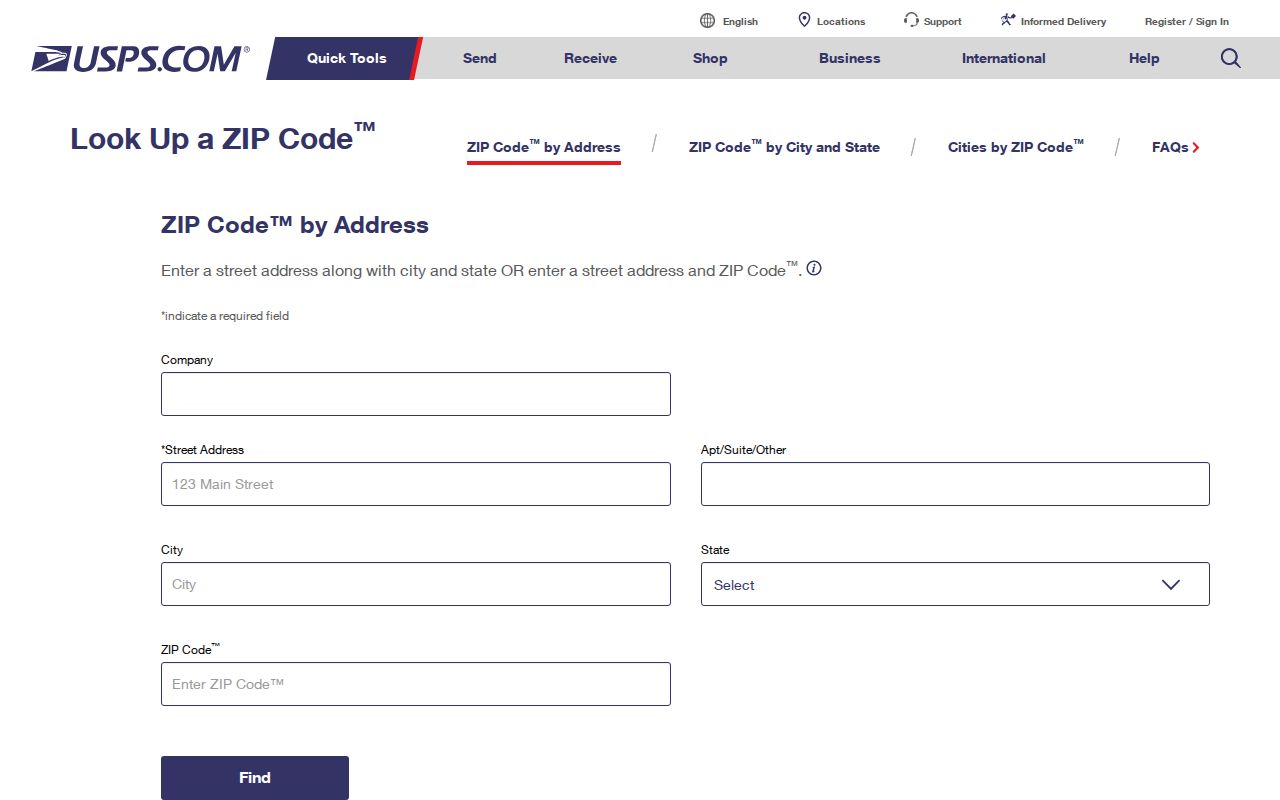
Preserve the returned postal form alongside the original source form so an older deed, directory, or tax record is not silently rewritten to match a current mailing format.
Washington Township ZIP Search Fields
ZIP filtering exists in only a few official systems reviewed for this area, and each filter has a narrow role. The Ohio Department of Rehabilitation and Correction search is an example: it lets a user narrow DRC records by ZIP, but it does not establish that someone currently lives in Washington Township or at any particular address. Its record population includes incarcerated, released, supervised, and violator statuses. A ZIP match there is not a local directory result and cannot be reversed into a neighborhood list.
| Ohio DRC field | Type | Required | Limit of the ZIP-related search |
|---|---|---|---|
| Last Name | Text | No | Prefix-style surname search; it is a DRC record field, not an address confirmation. |
| First Name | Text | No | Optional narrowing field. |
| Residential County | Dropdown | No | County is not a verified current street-address field. |
| ZIP | Text | No | Optional DRC narrowing field, not a Township boundary or present-residency test. |
| Status | Multi-choice selector | No | Includes All, Incarcerated, Released, APA Supervision, and Violators at Large. |
Ohio Unclaimed Funds also exposes optional City and ZIP fields for a claimant or property search, but a name match still requires verification and is not proof of identity or residence. Neither system creates a Washington Township postal directory of residents.
Washington Township ZIP Property Searches
The county’s property forms do not turn a ZIP into a parcel-search key. The reviewed Auditor Address and Owner Name screens have no ZIP field. The Address Search uses Number and Street Name; Owner Name uses LastName FirstName. The Treasurer route uses parcel, owner, or address fields. The current county voter form is also name-based, with no reviewed ZIP field. These limits matter because a ZIP narrowing feature in one official service does not mean all records can be searched the same way.
The Auditor Advanced Search displays a criteria builder with a Criteria control, dependent selection, date fields where supported, Sound Like checkbox, and tax-year and sorting controls. The reviewed interface did not expose the dynamic criterion list. It must not be described as offering a ZIP criterion.
The official Auditor Advanced Search screen shows the criteria-building controls whose unexposed options should not be assumed.
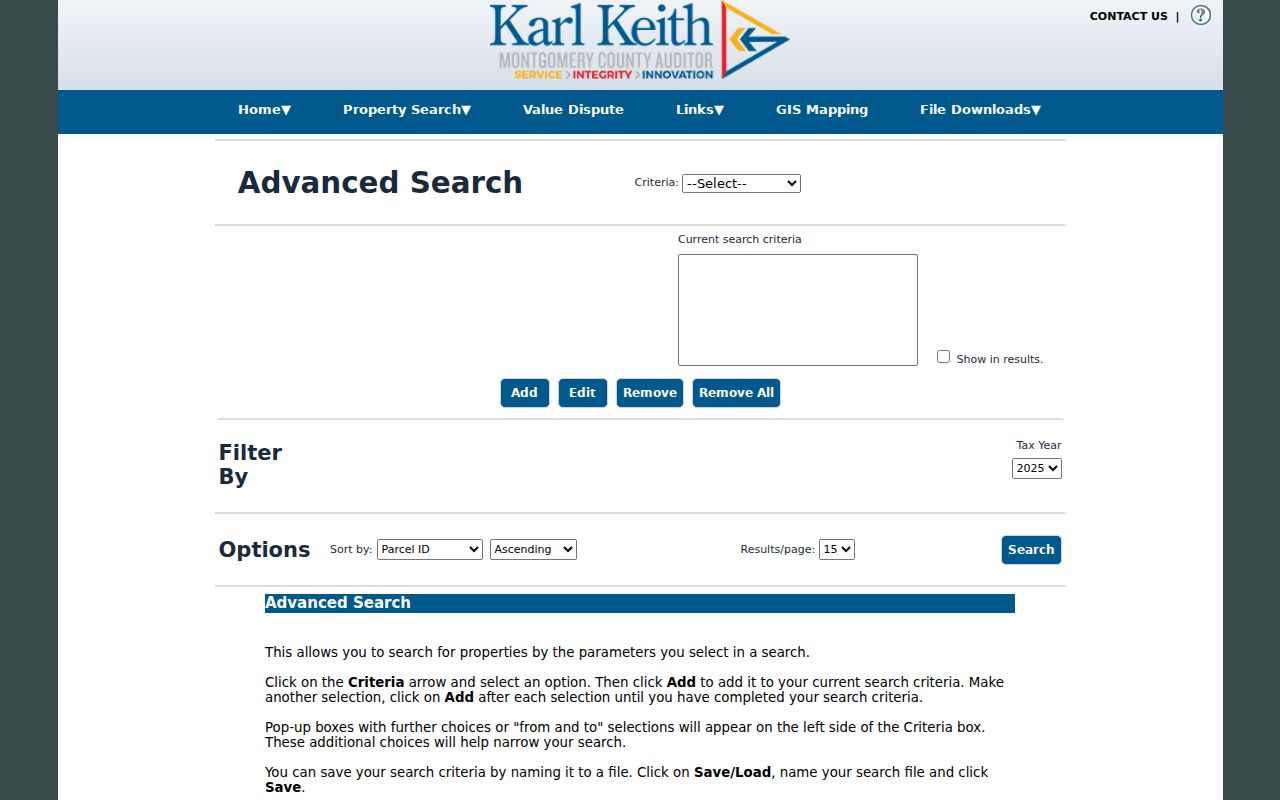
Use the visible address, owner, or parcel routes for a known property and record their date context, rather than adding an unsupported ZIP condition to an advanced query.
Washington Township ZIP Address Roles
Parcel records distinguish several address roles that can look alike in a postal search. A situs address is the physical property location. A tax mailing address is the address used for tax correspondence and can differ from the situs. An owner entry is an assessment or tax-record label for the stated year. A recorded deed names parties to a document. Each may carry a postal city and ZIP, but none should be transformed into a claim of current residence without a source that actually establishes it.
The Treasurer’s reviewed parcel schema makes the mailing-versus-situs distinction visible: it contains a Parcel group with Address and a Current Owner group, as well as Tax Mailing Name and Address fields. That is why an address research note should preserve the role, source, tax year, and date accessed. The parcel ID and legal description are more durable links across Recorder, Treasurer, GIS, historic map, and title work than a modern delivery code.
Note: Write down whether an address is postal, situs, tax mailing, or recorded-document context before comparing two records.
Washington Township ZIP Boundaries
A ZIP answers a delivery question, not a municipal-boundary question. The local examples make that plain: a Township government address carries a Dayton label, while a Township cemetery address carries a Centerville label. Neither fact maps every delivery point in either ZIP. When a record request concerns zoning, permits, or another locally held file, first check the full address through USPS, then match it to the Auditor and GIS. Contact the Township or the relevant city custodian only after that jurisdiction check.
- ZIP
- A USPS delivery-routing designation attached to a standardized mailing address. It is not a local-government boundary.
- ZIP+4
- A more specific postal add-on used to refine delivery within a ZIP. It does not identify parcel jurisdiction.
- PO-box ZIP
- A ZIP used for post-office-box delivery. It does not show the location of a person’s physical property.
- Carrier route
- A postal delivery grouping used to organize mail. It is not a parcel map or a resident roster.
Washington Township ZIP Code History
Modern postal codes are a poor shortcut for historical place research. A deed may use a lot and plat. A tax record may use a parcel identifier. An older directory can abbreviate a road or use a community label, and USPS may standardize the current suffix and postal city. Preserve the original wording as evidence, then use a normalized research key only to compare sources. Do not overwrite the older form or state an address conversion that the documents do not prove.
Woodbourne is one local example of why historic labels matter. Local history describes an early settlement and later suburban development under that name. A record marked Woodbourne can be geographically relevant to the Washington Township area even when a current mailing address uses Centerville or Dayton. Move from the historical form to a legal description, plat, parcel, or dated map before connecting it to a present property. That comparison is more reliable than attempting to infer an older location from a current delivery code.
Washington Township ZIP Code Limits
The available research does not support an exhaustive ZIP code directory for Washington Township. It supports a careful address-by-address process and two documented local postal examples. Do not display a ZIP as a complete list of streets, parcels, households, or residents. Do not reverse a postal code into person or address information unless an official tool expressly allows the particular query and the result is appropriate to use. The reviewed local portals do not create a general ZIP-to-resident search.
If a known parcel is in Washington Township and an older zoning or permit record is needed, identify the address or parcel, approximate date, and requested record type through the Township public-records route under Ohio Public Records Act, R.C. 149.43. If a property lies in another jurisdiction, use that custodian instead. This keeps postal delivery verification separate from public-record custody and avoids making a ZIP carry more meaning than the evidence supports.
For historical work, prefer the parcel ID and legal description to a current postal code. Deeds, tax duplicates, plats, maps, and printed directories can use different address forms or place names, and postal-city wording may change without changing the property itself. Retain the original form with its date, then compare it to the Auditor and GIS parcel record. Where the match remains uncertain, request the dated document from the Recorder, Records Center, or local custodian rather than filling the gap with a ZIP-based assumption.