
Tracing a Washington Township Street
Start with a full address, not a presumed household list. Washington Township includes unincorporated territory and incorporated Centerville, and a Dayton or Centerville postal label does not settle which local office holds a particular file. The first goal is a defensible parcel match. Keep the address as it appears on mail, an old document, or a map in research notes. Then use the base street name in the county form, save the parcel ID and legal description, and let each later record answer only the question it actually supports.
- Enter the house number and base street name in the Montgomery County Auditor address form. Keep the candidate address, parcel ID, legal description, tax year, and the owner label displayed for that property.
- Use the owner form only to reconcile the name shown on the parcel record. Its required name format is LastName FirstName, so it is not a substitute for an address-first search.
- Take the parcel ID and legal description to the Recorder path. A recorded deed can identify the parties and recording date, but a transfer alone does not establish who occupied the property.
- Use the current voter lookup only after a name is already known. Montgomery County’s reviewed form is name-based, not a browseable street roster, and protected addresses must remain protected.
- For an earlier period, ask a library or archive about a criss-cross or reverse directory for the exact year and place label. Treat any printed address association as dated evidence, not a current claim.
Note: A parcel and its legal description are the stable bridge when street spellings, postal labels, or historic place names differ.
Washington Township Street Search Fields
The Montgomery County Auditor Address Search is the practical opening record for a Washington Township street directory. Its instructions say not to enter a direction or suffix. The address screen accepts a Number and Street Name, with an asterisk available as a wildcard. This is an assessment and tax information service with read-only access. The county warns that its data may contain errors and gives no warranty, so the returned record should be saved with its tax year and checked against the parcel and deed trail rather than treated as a final answer about a household.
| Auditor route | Visible field | How to enter it | Useful limit |
|---|---|---|---|
| Address Search | Number | House number, optional with the street name | Match the result deliberately when several parcels are returned. |
| Address Search | Street Name | Base name only, no direction or suffix; * is accepted | No ZIP field was exposed on the reviewed form. |
| Owner Search | Name | LastName FirstName; wildcard examples are provided | Finds an owner index entry, not everyone associated with an address. |
| Parcel Search | Parcel ID | All or part of the identifier, without hyphens | Use it after the address result anchors the parcel. |
The official Auditor address-search screen shows the number-and-street route used to begin a Washington Township street directory search.
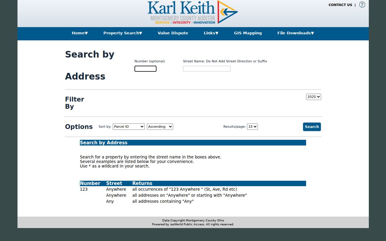
The screen’s direction-and-suffix instruction matters most when a street form in a deed or mailing address contains extra qualifiers that should still be retained in research notes.
The official Auditor owner-name search uses a separate LastName FirstName form for an ownership cross-check.
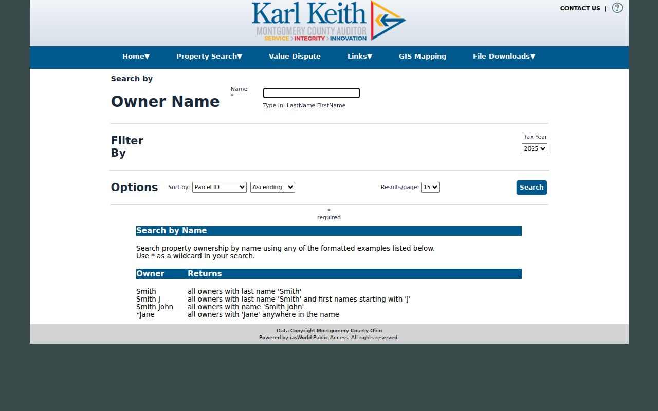
An owner-search match should be labeled as an assessment or tax-record owner result for the selected year, not as proof that the named person lives at the property.
Washington Township Street Parcel Context
The Auditor Interactive GIS Map helps distinguish a target parcel from a nearby or similarly numbered property. It supports address, street, and intersection searches, plus map navigation, selected-layer results, measurement, markup, spatial selection, and buffers. Use the map to see the parcel’s setting and to compare adjacent outlines after an address search. It is especially helpful where the Washington Township community description, a postal city, and the governing jurisdiction do not line up in the way a reader expects.
GIS geometry is context, not a legal survey. A buffer or measurement tool can orient a Washington Township street directory search, but it cannot decide a boundary, title, residence, or zoning-compliance question. For a boundary issue, follow a map cue to the recorded plat or survey through the Recorder or County Engineer. For ownership, return to the Auditor record and recorded instrument. The map does not supply verified resident information.
Washington Township Street Record Trails
Several custodians can hold address-related records for Washington Township, but their labels are not interchangeable. A property record may identify an owner or tax correspondence address. A recorded instrument names parties to a filing. A zoning file can identify an applicant or agent. A dated directory can print a name at an address. Keeping each label and record date prevents a street-by-street search from turning a narrow fact into a broad claim.
| Address record | Custodian | What to retain | Access route and limit |
|---|---|---|---|
| Assessment and tax parcel | Montgomery County Auditor | Parcel ID, legal description, tax year, owner label | Read-only address, owner, and parcel forms; not a household roster. |
| Parcel map | Auditor GIS | Selected parcel and map context | Online map for orientation; not a survey or ownership result. |
| Deed, plat, easement, lien | Montgomery County Recorder | Instrument, parties, recorded date, legal description | RISS entry is gate-controlled; office terminals and staff are fallback paths. |
| Tax duplicate | Auditor and Records Center | Year, value or transfer notation, parcel description | Auditor records begin in 1984 under the county guide; Archives has 1803-1983 duplicates. |
| Zoning or permit file | Washington Township Development Services | Address or parcel, project year, record type | Request a specific releasable file; no verified historic public address index was found. |
| Current voter lookup | Montgomery County Board of Elections | Name and lookup date | Name-based verification only, with no reviewed street or ZIP browse mode. |
- Parcel
- A county-defined property unit identified by a parcel ID and connected to assessment and tax records.
- Situs address
- The property’s physical location label in a parcel record. It can differ from a tax mailing address.
- Plat
- A recorded map or plan used to describe lots, streets, and related legal property information.
- Criss-cross directory
- An address-first printed directory that may list a name for a specific edition and area.
Washington Township Street Deed Trail
After an Auditor result identifies the parcel and current owner label, the next question is whether a recorded document carries the same legal description. The Montgomery County Recorder’s Recorder’s Information Search System, or RISS, opens at a legal-disclaimer and login screen. The reviewed entry page did not expose internal search fields or a beginning online index date. That is a reason to use only the access methods the county documents: RISS if authorized, Recorder office terminals, and staff help for the exact index route.
The county’s home-and-property guide places deeds at the Recorder from 1805 to the present. For older work, its archival materials point to deed indexes and books at the Records Center, although the documented endpoint for some deed books differs between county sources and should be confirmed with staff before ordering copies. Follow the legal description, tract, or plat reference as ownership changes. A mortgage release is not evidence of a move, and a deed can transfer property among relatives or through an estate.
The gate screen for the Montgomery County Recorder RISS system is the documented starting point for the Washington Township street directory deed path.
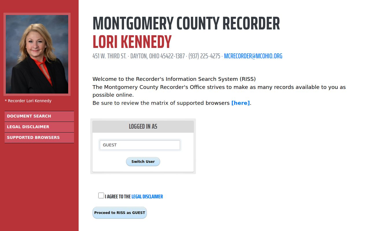
Record the instrument date and legal description with every document lead, then compare it to the parcel instead of relying on a street name that may have changed form.
Washington Township Street Tax Eras
Tax records give the Washington Township street directory a dated property layer. The county research guide places Auditor tax records in 1984 to the present and tax duplicate records in the Records Center for 1803 through 1983. Annual duplicate entries can provide property or improvement values, taxes, delinquencies, and a possible transfer indication. They are useful for deciding which year to investigate next, particularly when an address is older than the online system or is described by township, section, and range rather than a city lot.
A sharp change in improvement value is only a clue for construction timing. The county guide suggests examining the actual notations before drawing a conclusion, and a value change does not establish a move-in date. County Engineer imagery supplies another dated layer from 1938 forward. The 1938-1995 imagery is scanned and georeferenced, while imagery from 2000 forward is orthorectified. Each image can support a time-bounded observation about physical context, not an occupancy claim.
Note: Compare a tax or image date with a recorded plat, deed, or permit file before describing a property change.
Washington Township Street Name Forms
Historic address work needs more than a modern mailing line. Washington Township and Montgomery County began in 1803, while Centerville’s legal and community descriptions changed over time. Records may be filed under township, village, city, road-community, subdivision, lot, or section-and-range language. Woodbourne is a particularly important older place name: local history identifies it as an early settlement and later-subdivision context. A record labeled Woodbourne may be geographically relevant even if a modern address is presented as Centerville or Dayton.
No authoritative Washington Township-wide street-renumbering ordinance, conversion table, or effective year was located in the reviewed sources. Do not convert an old street number merely because a route looks similar on a modern map. Preserve the original spelling, postal city, road name, lot or plat, and source date. Then request historic maps, plats, planning or road records from the appropriate Township or County office and reconcile the legal description with the current parcel.
Washington Township Street Permit Files
For a Washington Township address, Development Services is the local route for zoning, permit, public-hearing, property-maintenance, and related Township-created records. The office is at 8200 McEwen Road, Dayton, Ohio 45458, and its published contact number is 937-433-0152. The Township’s OpenGov route supports applications, tracking, updates, and payments, but the research did not find a verified public historic address-search database. A map result or application portal entry should not be presented as a complete permit history.
Use the Township public-records request route for an identified file that is not available online. State the parcel or address, approximate project year, record type, and preferred format. Ohio Public Records Act, R.C. 149.43, provides the governing access framework, subject to exemptions and redactions. The Township interactive zoning map can help check location and zone, but zoning is neither ownership nor residence evidence.
Washington Township Street Directory Dates
A reverse or criss-cross directory is useful only when its edition and geographic coverage include the address in question. Washington-Centerville Public Library is the local verification route for Centerville, Washington Township, telephone, yearbook, newspaper, and possible reverse-directory holdings. The reviewed library sources did not publish exact runs or a confirmed criss-cross coverage range. Ask staff for the exact address, estimated year, and alternate labels such as Centerville, Dayton, or Woodbourne before treating a directory as an available source.
The Dayton Room at Dayton Metro Library is a countywide alternative with more than two centuries of regional historical material, including maps, newspapers, microfilm, and local-history staff. Record the edition, page, printed address wording, and date from any listing. A dated listing can add a name-and-address association to a property trail, but it does not establish title or current residence. For collection-focused research, use the Washington Township city directories route rather than turning a single listing into a complete street record.
Washington Township Street Directory Limits
A Washington Township street directory cannot establish everyone who lives at an address. The Auditor’s property service is an assessment and tax resource. A tax mailing address can differ from the situs address. RISS identifies recorded document parties, while maps show spatial context. The current county voter form requires a first and last name, and it does not provide an address-first street roster. Records may also be dated, redacted, sealed, confidential, or protected through Ohio’s Safe at Home program. A missing result is not permission to infer one.
Lawful use. Use street and address records for personal, lawful research. Do not use a parcel, map, deed, directory, or voter result to stalk, harass, intimidate, or harm another person.